The Gray/Grey Zone
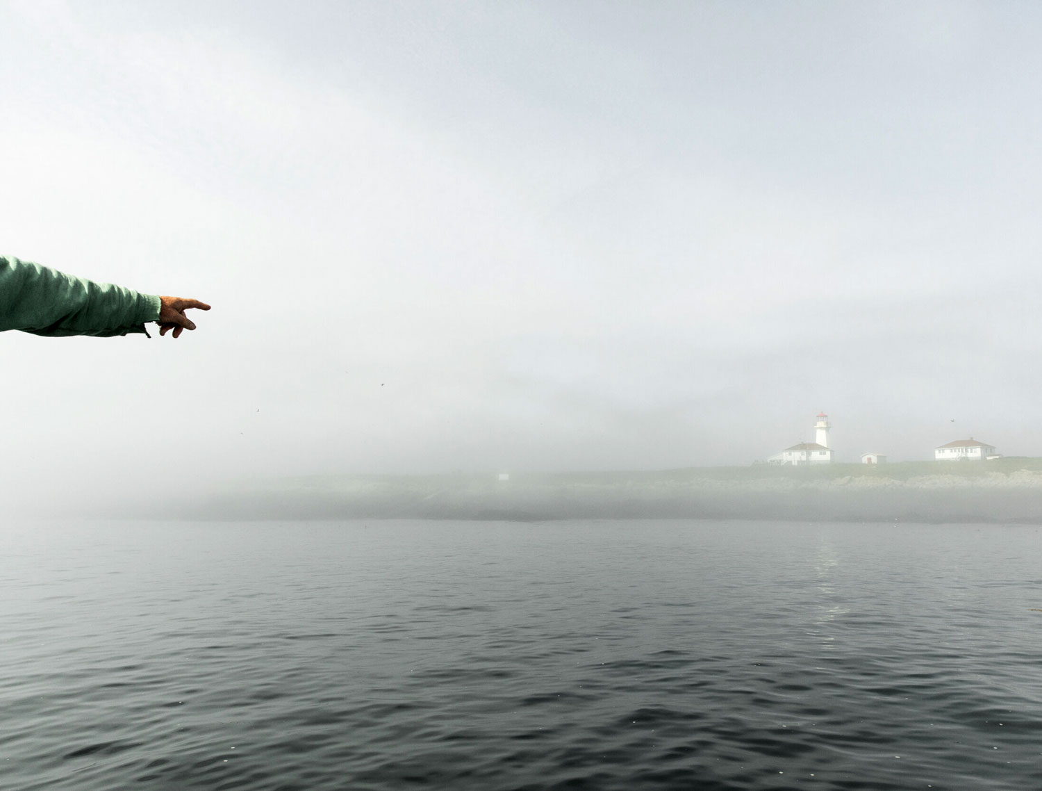
Machias Seal Island, Canada/United StatesConsidered to be the world’s longest border, the dividing line between Canada and the United States hosts a range of traditional border conditions such as ports of entry, patrolled and surveillance areas, and borderland communities that define the relatively stable and connected relationship between these two allies. Which is why it was surprising to learn that part of the geometry or trajectory of the border is disputed by both nations — driven by an unassuming, and (for the most part) vacant island on the east coast.
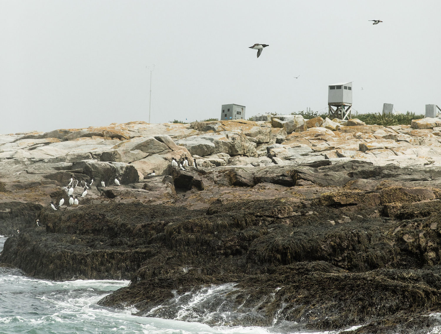
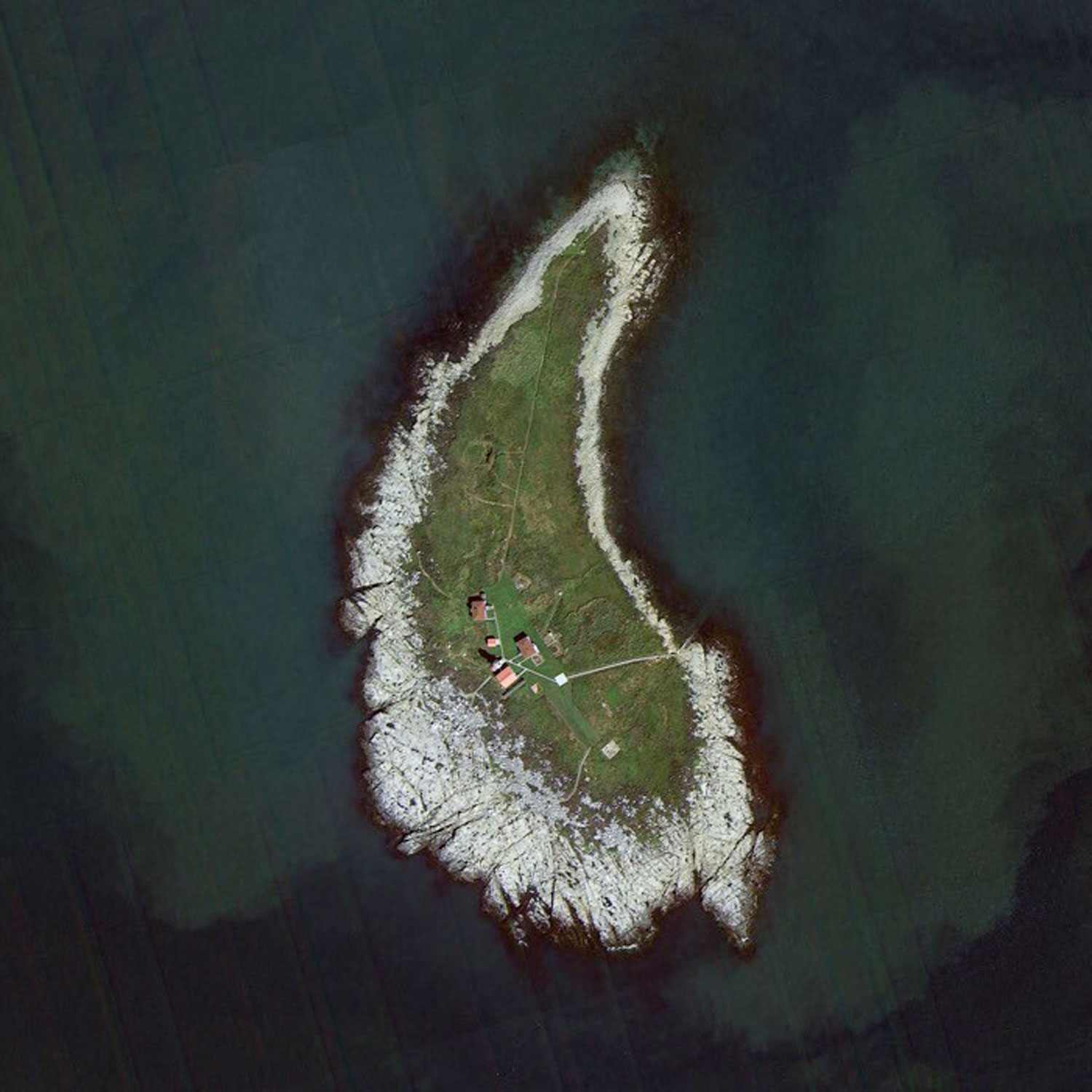
Machias Seal Island, located roughly 10 miles off the coast of Maine (in the US) or Bay of Fundy (in Canada) is a 20-acre rocky island, nicknamed “the grey zone.” In an effort to claim this territory, Canada installed a lighthouse in 1832, which is still staffed by a lighthouse keeper to this day. The US also claims sovereignty over the island and operates a birdwatching tour of the island. Both nations use tactics of territorial occupation over this patch of dry land — a site that was most likely overlooked or seen as inconsequential by both sides when the border was first established in 1783.
Grey areas or ‘no-man’s lands’ intrigue us. Whether at the scale of a nation state or on a site within an urban or rural setting — overlooked or ‘loophole’ conditions provide opportunities to explore and speculate on architectural and spatial practice untethered by traditional conventions or rules. These undefined or indeterminate sites allow us to explore how borders and territory construct inclusion and exclusion in space, and how as designers we can engage with border conditions to operate on the edge, margins and thresholds in-between.
(Aerial photo by The Centre for Land Use Interpretation. All other photos credited to Greta Rybus, a photographer based in Portland, Maine — who has beautifully captured this strange island, along with other locations in Maine and abroad)